Great Victoria Desert - Nullarbor Expedition seat in vehicle
- Trvanie: 16 Dní
- Kód produktu: GVD
The Great Victoria Desert is one of Australia’s hidden treasures - a vast sand dune and sand plain desert - the largest in Australia. Its area is shared equally by the States of South and Western Australia, north of the Nullarbor Plain and south of the Musgrave Ranges, and is bounded on the west by Laverton and the goldfields and to the east by Mabel Creek Station due west of Coober Pedy and the Stuart Highway.
The desert was named after Queen Victoria by the explorer Ernest Giles in 1875. Its dunes trend east west, and aside from the major palaeo-drainage basin at Serpentine Lakes it has no major watercourses. Save for a few vehicle tracks, this vast wilderness is virtually untouched by man. The international significance of the Unnamed Conservation Park that lies on the South Australian side of the desert was recognised in 1977 when it was proclaimed a Biosphere Reserve by UNESCO. It is one of the largest arid zone biospheres in the world.
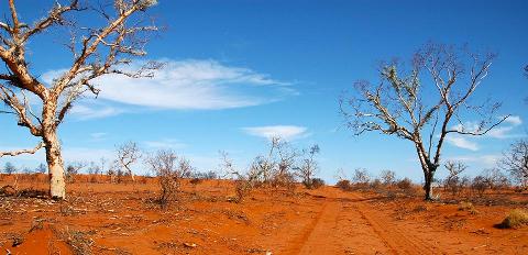
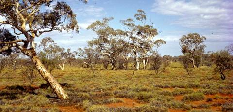
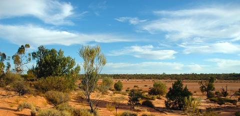
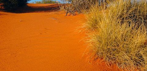
Sandplains and dunefields are the dominant landform, forming the southern part of the anticyclonic whorl of dunes that include the Simpson and Great Sandy Deserts. The dunes are longitudinal, from 5-20 metres in height and can run for up to 100kms. Salt lakes are another feature of the desert, the best known are the Serpentine Lakes, other lake systems are the Nurrari and Wyola Lakes, Lakes Maurice and Bring, and Plumridge Lakes and Yeo Lakes in Western Australia.To the south is the vast limestone Nullarbor Plain, and to the south east Tietkins Plain and the Ooldea dunefields.
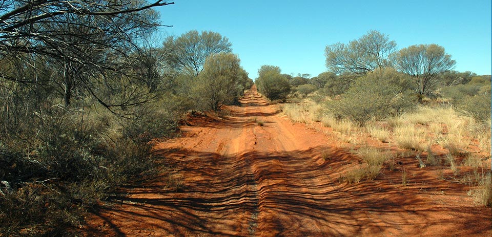
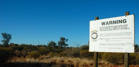
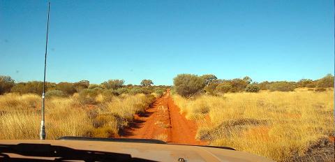
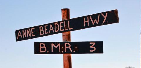
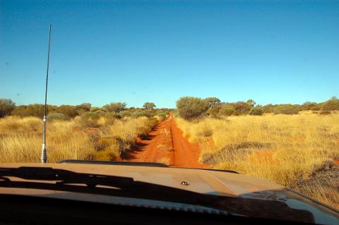
This expedition travels across an extraordinary diversity of landscapes and vegetation, the scenery changing constantly. Both the Nullarbor and the Great Victoria Desert are veritable Botanic Gardens teeming with life. Departing Coober Pedy, (which is serviced daily by Rex Air from Adelaide) we travel west on the famed Anne Beadell Highway through Aboriginal Land to Tallaringa Nature Reserve. We visit once top secret ground zero at Emu Field, the site of the first atomic tests on Australian soil. We cross the GVD along the Anne Beadell Highway to Laverton. From the goldfields we return across the northern Nullarbor, crossing expansive and evocative sweeping plains. This program offers an astonishing diversity of landscapes and scenery.
Day One
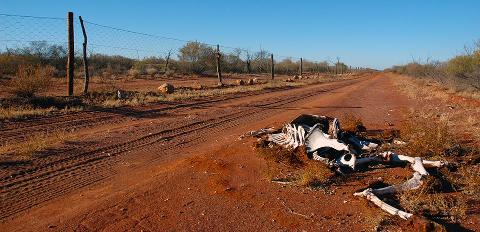
We pick up from all Coober Pedy hotels mid morning and meet the incoming flight from Adelaide. We head west onto Aboriginal owned Mabel Creek Station. Following station tracks we arrive at the Dog Fence, the world’s longest man made structure. Crossing the fence signifies our arrival in a desert wilderness, with the next settled land close to Laverton in Western Australia. We travel west and camp in the Tallaringa Conservation Park. Tallaringa well was a native well, rediscovered by the explorer Maurice. Len Beadell relocated the well in 1951 using astrofixes to determine Maurice’s original co-ordinates.
Day Two
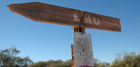
Our first morning in the Outback, awake to birdsong, a blazing campfire, fresh brewed coffee or billy tea, and a hearty breakfast. We break camp and head west towards Emu. We visit ground zero at Totem 1 & 2 atomic sites. We check out Observation Hill where Len Beadell stood with Sir Thomas Penny to observe the first atomic detonation on the Australian mainland. We visit the camp area and the emu clay pan before heading west to camp amongst beneath casuarinas in limestone country.
Day Three-Seven
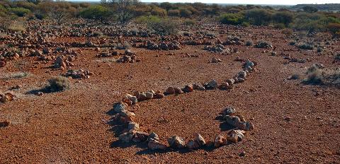
We enter the magical Great Victoria Desert. Over the next five days we travel westward, largely along internal corridors thick with an astonishing array of vegetation. The road we take is the Anne Beadell Highway, which is really a track not a highway. We enter Marlinga Tjarutja Aboriginal Lands and travel west to the first junction Vokes Hill. On through the desert we enter the Mumungari Conservation Park. We preferred its previous name “The Unnamed Conservation Park”, but who are we to stand in the way of progress. The park is an UNESCO World Biosphere reserve. The vegetation is stunning, with karrajong, acacias, hakeas and majestic marble gums. We cross the paloedrainage basin known as the Serpentine Lakes. We camp on beautiful red clay pans surrounded by native pines. We visit Aboriginal wells, one of Australia’s most extensive Aboriginal stone arrangements, the wreckage of a Goldfields Airways twin engine Cessna that crash landed in 1993. We visit Australia’s most remote roadhouse at Ikkurlka, the crossing of the Connie Sue Highway at Neales Junction, and eventually arrive in Laverton in the Western Australian Goldfields.
Day Eight
We visit Lake Ballard, the site chosen by British sculptor, Sir Antony Gormley, to display his world-famous ‘Inside Australia’ art installation of 51 sculptures known as the Antony Gormley Sculptures. We will head to Lake Niagara, built by CY O’Conner - the visionary behind the Perth to Kalgoorlie pipeline. No visit to the area would be complete without dropping in to the famous Grand Hotel in Kookynie. Built in 1902 it is the quintessential outback pub.
Day Nine
We trek eastward to Pinjin, a ghost town where little remains of a brief gold rush in the early 20th century. We gradually enter more and more remote country. We take a walk around the Kirgella Rocks, scenic granite outcrops. We visit Queen Victoria Springs, named by Ernest Giles and gradually make our way into the Plumridge Lakes Nature Reserve. The first Europeans to Plumridge Lakes was Ernest Giles party in 1875. The next visitors were the Elder Scientific Exploring Expedition led by David Lindsay. The lakes were eventually named by the explorer Frank Hann in 1908 after one of this travelling companions. The Plumridge Lakes area was an important region for Sandlewood harvesting from 1930s until 1980s.
Day Ten
A day of great variation of scenery as we push eastward through the Great Victoria Desert. Gradually the heavily vegetated country gives way to stunning bluebush plains interspersed with stately western myall. These trees love limestone and are indicative that we are gradually approaching the worlds largest limestone plain - the Nullarbor. We cross the Connie Sue Highway, another Len Beadell road and head into country seldom traversed. We drive along old rabbitters tracks through stunning rolling plains. We are north of the Nullarbor and south of the Great Victoria Desert and there is a wonderful feeling of vastness and remoteness.
Day Eleven
We wind our way southward through the remains of old rabbiters camps across vast endless plains until we arrive at the tiny hamlet of Forrest on the Trans Pacific Railway. There is lots to see and do here. Once a stop over for airplanes en route from Adelaide to Perth, there is an historic aircraft hanger, an abandoned meteorological station and numerous buildings. There is also an automatic meteorite tracking facility. There is also the chance of a shower to wash off the desert dust.
Day Twelve
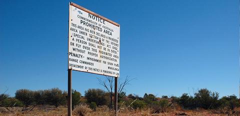
We follow the railway line east. It is a surreal experience as the rail line is dead straight for hundreds of kilometres. Occasionally a freight train will pass, there are siding ruins, old tips and beacons that once provided lights for airplanes traversing the continent. We stop at the township of Cook where there is a shop and small museum and continue on to Watson. We leave the railway and head north towards Marlinga - the field of thunder, where Australia conducted nuclear tests in the 1950s. We will camp at Maralinga Village.
Day Thirteen
A full day tour of the Maralinga village, bomb sites and testing ground. We will camp south near Ooldea siding which for many years was the home of Daisy Bates.
Day Fourteen
Ater exploring Ooldea and the surrounding area we travel east through sandhills to Wynbring, and extraordinary granitic outcrop. There are some wonderful short walks to be enjoyed in the area.
Day Fifteen
Ater exploring Wynbring we follow alongside the vermin proof fence past Lyons to Malbooma and on to Tarcoola, the junction of the Sydney-Perth and Adelaide Darwin railway lines. Tarcoola reputedly has a population of two since the Pub, one of only two iron- clad hotels in South Australia closed. We continue on past Wilgena and Ferguson sidings to Kingoonya, where there is a pub that’s still open. Kingoonya is reputed to have the widest main street in Australia, but since the railway was rationalised, all there really is left is the pub.From here we travel south past Lake Gairdner and camp along the road to Gawler Ranges National Park.
Day Sixteen
Leaving the Gawler Ranges we arrive in wheat country. Gradually the country becomes more civilised as we pass Iron Knob and Kimba to make our way to Port Augusta. From Port Augusta we trek south to Adelaide arriving early evening at city hotels and the end of an extraordinary adventure.


